
Australia’s vast coastline holds an extraordinary secret: enough untapped energy in our waves, tides, and ocean currents to power millions of homes. Marine energy atlases are unlocking this potential by mapping where these powerful forces converge, transforming abstract ocean movement into concrete renewable energy opportunities.
These specialized digital tools combine satellite data, oceanographic measurements, and sophisticated modeling to identify prime locations for ocean power technologies. Think of them as treasure maps for renewable energy developers, pinpointing exactly where wave farms and tidal generators can operate most efficiently along our 60,000 kilometers of coastline.
The practical value is immense. Project developers use marine energy atlases to slash feasibility study costs by up to 70%, avoiding expensive site assessments in unsuitable locations. Policymakers gain data-driven insights to designate marine energy zones, while investors access risk profiles that make financing decisions clearer. For coastal communities from Tasmania to Queensland, these atlases reveal opportunities to create local jobs while strengthening energy security.
Recent advances have made marine energy atlases remarkably accurate, incorporating real-time ocean conditions and seasonal variations. Tasmania’s northwest coast, for instance, has emerged as a hotspot with wave energy densities exceeding 40 kilowatts per meter, while Western Australia’s Pilbara region shows exceptional tidal energy potential. As Australia accelerates toward net-zero emissions, these atlases provide the strategic intelligence needed to harness our greatest untapped renewable resource: the relentless power of our surrounding oceans.
What Is a Marine Energy Atlas and Why Does It Matter?
The Technology Behind the Maps
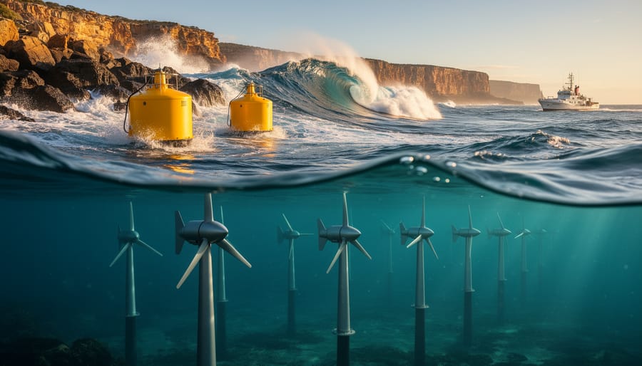
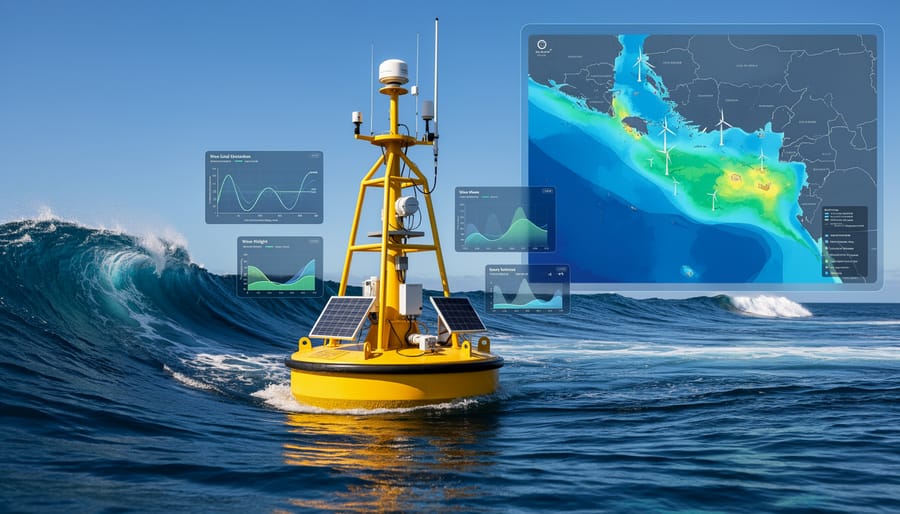
Creating a marine energy atlas is like assembling a detailed weather map, but for ocean power. These remarkable tools combine data from multiple sources to paint a comprehensive picture of where renewable energy lies beneath the waves. Satellites orbiting Earth continuously measure wave heights, ocean temperatures, and current speeds, sending back valuable information in real-time. Meanwhile, ocean buoys stationed across our coastlines act as sentinels, recording precise local conditions including tidal movements and wind patterns at sea level.
This raw data then feeds into sophisticated modelling software that processes millions of data points to identify the most promising locations for marine energy projects. The software accounts for seasonal variations, weather patterns, and long-term trends, essentially predicting where consistent, harvestable energy exists. Think of it as Google Maps for ocean power, showing developers exactly where to focus their efforts.
What makes these atlases particularly powerful is their accessibility. Complex oceanographic data transforms into visual maps that anyone can understand, making it easier for communities, investors, and policymakers to spot opportunities right off their local coastline and make informed decisions about Australia’s renewable energy future.
From Data to Action
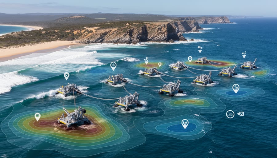
A marine energy atlas transforms complex data into actionable intelligence for real-world applications. Project developers use these atlases to pinpoint the most promising locations for wave, tidal, and ocean current installations, dramatically reducing the time and cost of preliminary site assessments. Instead of spending months surveying potential areas, developers can identify high-energy zones within days, examining factors like wave height consistency, water depth, and proximity to existing grid infrastructure.
For energy forecasting, the atlas provides historical patterns and seasonal variations, enabling accurate predictions of power generation. This information is crucial for grid operators planning how marine energy fits alongside solar and wind in Australia’s renewable mix. Site selection becomes more strategic when atlas data reveals not just energy potential but also environmental constraints, helping developers avoid sensitive marine habitats from the outset.
The practical value shines in Tasmania, where atlas mapping identified optimal tidal stream locations near existing transmission lines, fast-tracking feasibility studies. Similarly, Western Australian wave energy projects have used atlas data to secure investor confidence by demonstrating consistent energy resources. This evidence-based approach turns promising concepts into bankable projects, accelerating Australia’s journey toward clean, reliable ocean power that complements our sunshine and wind resources.
Australia’s Ocean Energy Goldmine: What the Atlases Reveal
Wave Energy Hotspots
Australia’s southern coastline harbours some of the planet’s most consistent wave energy resources, with marine energy atlases revealing extraordinary potential along Western Australia, South Australia, and Victoria’s coasts. The Southern Ocean’s powerful swells deliver energy densities exceeding 40 kilowatts per metre of wave front in prime locations off Perth and Portland. These hotspots could theoretically power hundreds of thousands of homes if harnessed effectively.
King Island, situated in Bass Strait, demonstrates this potential brilliantly. While not yet tapping wave energy at scale, the island’s success with hybrid renewable systems shows how isolated coastal communities can leverage their natural advantages. Similarly, mapping efforts around Tasmania’s west coast have identified sites where wave energy converters could complement existing wind and hydroelectric infrastructure, creating resilient energy networks for regional communities while protecting pristine environments from fossil fuel dependence.
Tidal Power Opportunities
Australia’s northern coastline harbours some of the world’s most powerful tidal currents, and marine energy atlases are revealing just how extraordinary this resource truly is. The Kimberley region in Western Australia experiences tidal ranges exceeding 11 metres, creating immense energy potential that’s been meticulously mapped through advanced atlas technologies.
These detailed tidal assessments identify prime locations where underwater turbines could generate reliable, predictable electricity. Unlike solar and wind, tidal power operates on clockwork precision, making it perfect for grid stability. The technology works beautifully alongside other renewables, filling gaps when the sun sets or winds calm.
Several pilot projects are already underway in Darwin Harbour and King Sound, where atlas data has pinpointed optimal deployment sites. These initiatives aren’t just about clean energy, they’re creating local engineering jobs and positioning Australia as a Southern Hemisphere leader in marine energy innovation. With atlas mapping becoming more sophisticated, we’re only beginning to tap into the ocean’s tremendous power potential.
Ocean Thermal Energy Potential
Australia’s tropical northern waters hold remarkable potential for ocean thermal energy conversion (OTEC), a technology that harnesses temperature differences between warm surface water and cold deep ocean currents. In regions where surface temperatures exceed 25°C while depths below 1,000 metres remain around 4°C, this temperature gradient can drive turbines to generate clean, reliable electricity around the clock. Unlike solar and wind, OTEC provides genuine baseload power, making it particularly valuable for remote island communities and coastal industries in Queensland and the Northern Territory. Marine energy atlases help identify optimal OTEC sites by mapping thermal layers, ocean depths, and proximity to energy demand. While still emerging commercially, pilot projects overseas demonstrate OTEC’s promise for Australia’s vast tropical coastline, potentially powering everything from desalination plants to aquaculture facilities whilst creating regional jobs in marine engineering and renewable technology sectors.
Success Stories: Marine Energy Atlases in Action
International Pioneers Leading the Way
Scotland has emerged as a global trailblazer in marine energy, thanks largely to its comprehensive marine energy atlas. The Scottish Government’s atlas mapped tidal stream and wave resources across its coastline, directly informing the location of the European Marine Energy Centre in Orkney. This facility has since tested over 25 wave and tidal devices, creating hundreds of skilled jobs and attracting international investment. Canada followed suit with its own detailed mapping initiative, identifying prime locations in the Bay of Fundy where tidal currents reach extraordinary speeds. These efforts guided the deployment of demonstration projects that now feed clean electricity into the grid. France’s atlas revealed significant wave energy potential off Brittany’s coast, sparking a marine energy cluster that combines research, manufacturing, and deployment. These success stories demonstrate a clear pattern: nations that invest in detailed resource mapping create confidence for investors, reduce project risks, and accelerate the transition from concept to operating marine energy farms that deliver tangible environmental and economic benefits.
Australian Projects Taking Shape
Australia’s vast coastline is no longer just admired for its beauty—it’s becoming a powerhouse for renewable energy innovation. Several promising projects are already leveraging marine energy atlas data to turn potential into reality.
In Tasmania, developers are using detailed tidal stream mapping to identify prime locations for turbine installations in Banks Strait. This data-driven approach has helped secure funding and fast-track environmental approvals by demonstrating minimal impact on marine ecosystems while maximising energy capture.
Along Victoria’s coast, wave energy pilot programs are using atlas information to pinpoint the most consistent wave patterns, with one project near Portland showing particularly promising results. Local communities are excited about the prospect of new jobs in installation and maintenance, with early estimates suggesting dozens of long-term positions.
Western Australia’s strong tidal currents near King Sound have attracted international attention, with atlas data helping researchers understand seasonal variations and design systems that work with nature’s rhythms rather than against them. These initiatives aren’t just generating clean electricity—they’re building knowledge, creating skilled jobs, and positioning Australia as a leader in marine renewable technology.
The Practical Benefits for Australia’s Energy Future
Jobs and Economic Opportunities
Marine energy atlases aren’t just mapping tools—they’re blueprints for coastal prosperity. By identifying prime locations for wave, tidal, and ocean thermal energy projects, these atlases guide strategic investment that creates marine renewable energy jobs right where they’re needed most.
Regional coastal communities in Tasmania, South Australia, and Western Australia stand to benefit significantly. Manufacturing facilities for marine energy devices, installation and maintenance crews, and supporting industries like marine engineering all represent tangible employment opportunities. Unlike fossil fuel industries, these jobs are sustainable and locally anchored—turbines need ongoing servicing, facilities require operational staff, and supply chains strengthen regional economies.
The Port of Gladstone’s offshore energy precinct demonstrates this potential beautifully, with projections suggesting hundreds of skilled positions emerging over the next decade. Marine energy atlases help councils and developers plan strategically, ensuring infrastructure investments align with resource availability. This data-driven approach reduces risk, encourages private sector participation, and ultimately transforms fishing villages and regional centres into thriving renewable energy hubs.
Complementing Solar and Wind
One of marine energy’s greatest strengths lies in its reliability. Unlike solar and wind power, which depend on weather conditions, ocean currents and tides follow predictable patterns we can forecast months in advance. This makes marine energy the perfect partner in Australia’s renewable energy mix.
When clouds roll in or winds die down, ocean energy can keep the electricity flowing. Tasmania’s tidal streams, for instance, operate consistently regardless of whether it’s day or night, sunny or overcast. This predictability reduces our reliance on fossil fuel backup generators and strengthens grid stability.
Marine energy also pairs brilliantly with energy storage solutions. When integrated into a diversified renewable network, ocean power can charge batteries during low-demand periods, ensuring consistent supply during peak hours. For coastal communities across Australia, this complementary relationship means genuine energy security without compromising environmental values. It’s about building a resilient system where different clean technologies work together, filling each other’s gaps naturally and efficiently.
What Needs to Happen Next: Making the Most of Marine Energy Atlases
Marine energy atlases have opened the door—now it’s time to walk through it. Transforming these valuable insights into real, working facilities requires coordinated action across multiple fronts, and there’s never been a better moment for Australia to seize this opportunity.
Policy support stands at the forefront of what’s needed. Governments at both state and federal levels must establish clear regulatory frameworks that streamline approvals for marine energy projects while safeguarding our precious ocean ecosystems. Feed-in tariffs, renewable energy targets that specifically include marine energy, and grant programs for pilot projects can all accelerate development. When policymakers use atlas data to identify priority zones and fast-track suitable locations, we remove unnecessary roadblocks.
Investment is equally crucial. While marine energy technologies have matured significantly, they still need patient capital willing to back innovation. Superannuation funds, clean energy finance initiatives, and private investors all have roles to play in funding the transition from atlas mapping to actual turbines generating power. Success stories from Scotland and France demonstrate that early investment pays dividends through job creation and energy security.
Technology development must continue. Australian universities and research institutions can partner with industry to refine equipment for our unique conditions—designing turbines that handle our marine environments and withstand cyclone seasons in northern waters.
Finally, public awareness matters enormously. When communities understand the potential sitting just offshore, they become advocates for sensible development. Share these opportunities with your networks, support marine energy initiatives, and ask your representatives about their plans for harnessing our ocean power. The atlas shows us where to go—now we need collective will to get there.
Australia stands at the threshold of an extraordinary opportunity. Marine energy atlases are more than technical tools—they’re gateways to a cleaner, more prosperous future powered by our vast ocean resources. By mapping wave, tidal, and ocean thermal energy potential with unprecedented precision, these atlases transform what was once guesswork into strategic planning, helping communities, investors, and governments make informed decisions about where and how to harness the power of our seas.
The journey toward a renewable energy future isn’t just about technology; it’s about people. From coastal communities creating new employment opportunities to researchers pioneering innovative solutions, marine energy atlases help connect ambition with action. They reveal where the next wave farm might power thousands of homes or where tidal energy could strengthen regional energy security.
As Australians, we’ve always had a special relationship with the ocean. Now, it’s time to deepen that connection by supporting ocean-based clean energy initiatives. Whether you’re a policymaker exploring renewable options, a business leader seeking sustainable investments, or simply someone passionate about environmental stewardship, marine energy atlases provide the roadmap. Together, we can ride the tide of change and create an energy system that honours both our environment and our future.